Our new DeepCube publication “Deep Learning Methods for Daily Wildfire Danger Forecasting” has been accepted to the workshop on Artificial Intelligence for Humanitarian Assistance and Disaster Response at the 35th Conference on Neural Information Processing Systems (NeurIPS 2021).
We approach daily fire danger prediction as a machine learning task, using historical Earth observation data from the last decade to predict next-day’s fire danger. To that end, we collect, pre-process and harmonize an open-access datacube, featuring a set of covariates that jointly affect the fire occurrence and spread, such as weather conditions, satellite-derived products, topography features and variables related to human activity.
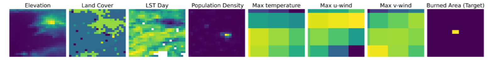
We implement a variety of Deep Learning (DL) models to capture the spatial, temporal or spatio-temporal context and compare them against a Random Forest (RF) baseline. Our DL-based proof-of-concept provides national-scale daily fire danger maps at a much higher spatial resolution than existing operational solutions.

To access and download the publication visit https://arxiv.org/abs/2111.02736
Cite the publication: Ioannis Prapas, Spyros Kondylatos, Ioannis Papoutsis, Gustau Camps-Valls, Michele Ronco, Miguel-Ángel Fernández-Torres, Maria Piles Guillem, and Nuno Carvalhais. “Deep Learning Methods for Daily Wildfire Danger Forecasting.” arXiv preprint arXiv:2111.02736 (2021).